Abbotsford could pick up another 10 centimetres of the white stuff today (Monday), as Environment Canada issues another snowfall warning.
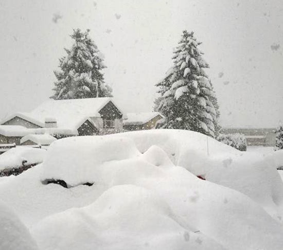
More than eight more centimetres of snow fell yesterday, bringing the total accumulation since Friday afternoon to about 45 centimetres in Abbotsford.
This is almost as much as the city’s average – 55 centimetres – for an entire year.
A low-pressure system moving across Washington State today will bring snow to the area today and continue through tonight as a second, broad low-pressure area follows.
Another five centimetres is expected tonight, with smaller accumulations expected daily until Friday.
All public and private schools in Abbotsford remain closed today, as will all campuses of University of the Fraser Valley.
Meanwhile, the Abbotsford Police Department on its Facebook page is warning drivers to avoid the Sumas flats area east of Whatcom Road and north of Vye Road due to "extreme snow drifts, treacherous road conditions and adverse weather."
Here’s a summary of the forecast for the coming days:
• Today: Snow. Amount 5 to 10 cm. Windy early this morning. Temperature steady near zero.
• Tonight: Snow. Amount 5 cm. Temperature steady near minus 2.
• Tuesday: Cloudy with a 60 per cent chance of flurries. High plus 1.
• Tuesday night: Cloudy. Low minus 6.
• Wednesday: Cloudy with a 60 per cent chance of flurries. High plus 3.
• Wednesday night: Periods of snow. Low minus 5.
• Thursday: Snow or rain. High plus 3.
• Thursday night: Snow or rain. Low zero.
• Friday: Showers. High plus 5.
• Friday night: Cloudy with a 40 per cent chance of flurries. Low minus 1.