Fresh off the opening of the Salton Road pedestrian and cycling bridge, city staff are looking at creating a new north-south bike corridor in another section of Abbotsford’s core.
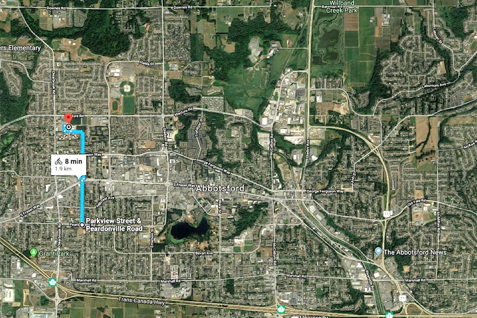
The city has launched an online survey about a planned “bikeway” along Parkview and Tims streets. The corridor would stretch from Dormick Park elementary school in the south to the Matsqui Recreation Centre in the north. It would also link up with the civic precinct that includes city hall, Clearbrook Library, and fire and police department headquarters. Gordie Howe middle school and W. J. Mouat secondary school would also be accessible at the north end of the route.
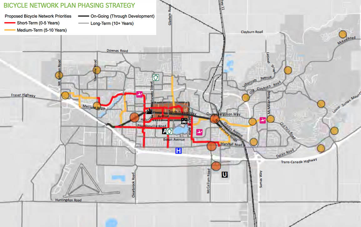
The corridor is just part of several routes identified in last year’s transportation master plan as short-term priorities for the creation of a cycling network through Abbotsford.
From the north of the corridor, the plan envisions a route west, toward Townline Road and – within 10 years – to Highstreet.
The south of the corridor would link up with cycling facilities to be built on Hillcrest Avenue and Peardonville Road, according to the plan. Other core cycling routes identified as short-term priorities include Ware Street, Simon Avenue, and Emerson Street.
To take the city’s survey, go to parkviewtimsbikeway.metroquest.ca.
RELATED: New bike lanes may be focused in central Abbotsford
RELATED: PHOTOS: Salton pedestrian/cycling bridge lowered into place
RELATED: New pedestrian and cycling bridge opens to public