Disaster awaits.
Not today. Probably not tomorrow (although, possibly tomorrow). Most likely not even in the next decade. But you can only roll a pair of dice so many times before you get snake eyes.
Although this year’s rising freshet waters have some eyeing the Fraser River more closely than normal, it remains unlikely the region will see anything more than localized flooding. But that shouldn’t obscure just how much danger the Fraser Valley’s rivers pose to Abbotsford – and how inaction has left the region’s dikes insufficient to deal with the various flood risks that threaten the city.
• • • • •
A catastrophic flood in Abbotsford won’t necessarily occur in the spring – or even with any warning.
One could, in fact, take place an hour after you read this.
Before you know of the flood, you will feel its cause. The earth will begin to shake, and it will keep shaking for some time. A massive earthquake has hit the West Coast, crumbling buildings across the Lower Mainland and northwest Washington. Abbotsford – many kilometres from the quake’s epicentre and with most buildings on reasonably solid ground – will seem to have been spared the worst of the quake’s destructive force, but it’s about to encounter a problem a century in the making.
Nearly 100 years ago, farmers drained what had been Sumas Lake, built a canal to redirect its waters to the Fraser River, and began farming its lakebed. An earthquake can undo all that.
Most dikes around the Lower Mainland are seismically unstable. But many aren’t needed very often. So unless a rare major earthquake hits at the same time as a rare major flood, a breach is unlikely, and the biggest challenge will be upgrading the dikes before the next freshet.
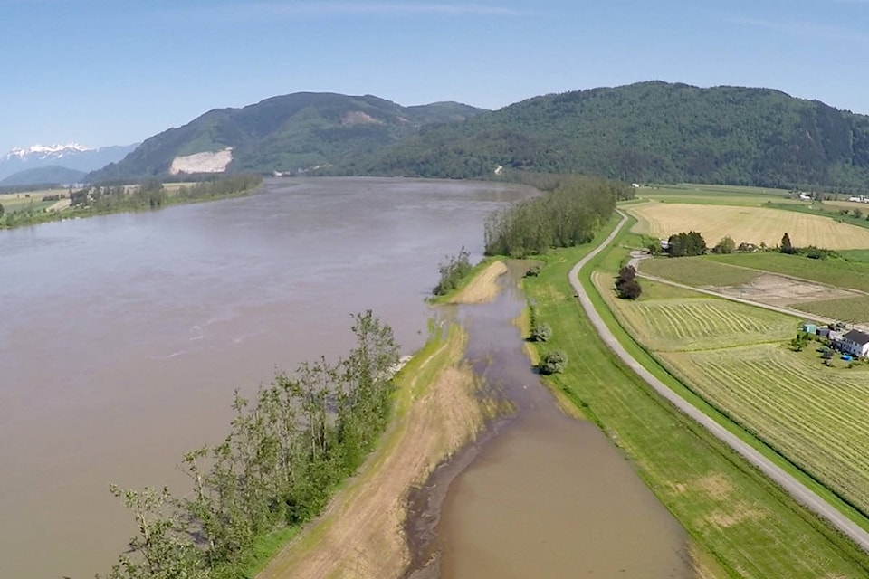
The dikes lining the Vedder Canal, on the city’s eastern border, are different. The former lakebed of Sumas Lake is at, or below, sea level. The water in the Vedder runs downhill into the sea. You can do the math.
“The problem with those dikes is, because it’s a lakebed, the ground elevation next to the Vedder dikes is very low,” Neil Peters, the province’s former head of flood planning, told The News. Meanwhile, a recent assessment found that the dike is “seismically unstable” and that “liquefaction and lateral spreading [is] likely under larger earthquakes.”
For much of the year, if the dike were to collapse, water from the Vedder would rush through the void. And recovering from such a flood would likely be a logistical nightmare. With the floodwaters having nowhere to go, so Abbotsford’s Barrowtown Pump Station would need to operate continuously to drain the area. But remember: the region would have just suffered a devastating earthquake. There’s no guarantee the station won’t be damaged, or even that it will have power. And the re-emergence of Sumas Lake would likely be deemed to be a smaller emergency than whatever has befallen Vancouver and Victoria.
• • • • •
Perhaps the most likely flood risk facing Abbotsford comes from a river many in the city have probably never heard of: the Nooksack River. The Nooksack carries water from the south and west slopes of Mount Baker west towards Lynden, Wash., before diving south and emptying near Bellingham. The river never crosses the border, but if it breaches its banks, its floodwaters will generally head north, downhill across the border to Sumas Prairie and, again, the former bed of Sumas Lake.
“The Nooksack is probably something people don’t appreciate as much as they should,” Peters said.
The river can flood anytime between November and February after heavy rains on Mount Baker. But because the river is south of the border, the water – once it escapes the Nooksack’s banks – wants to flow north, where are no dikes that would stop a major flood in its tracks.
“It’s a tricky political issue,” Peters said.
While Canadian and American representatives have worked together to model flows and co-ordinate responses to a possible flood, a dike system to limit flooding in Canada has been problematic, because nobody wants to have a home between the river and any barrier to stop floodwaters from continuing east towards the Sumas Lake bed.
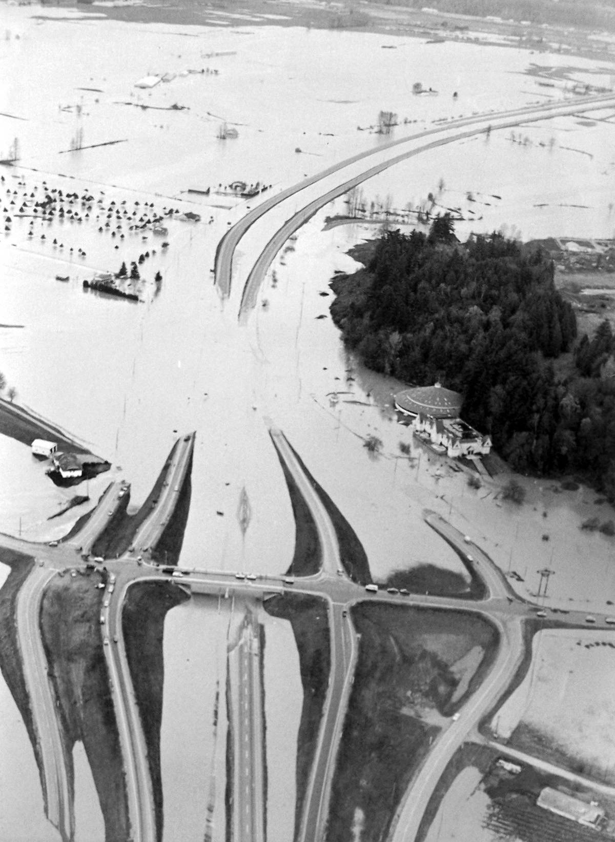
A Nooksack flood in 1990 swamped the Whatcom Road interchange and western portions of Sumas Prairie. Such a flood is expected to take place every 35 years or so. There are worries that a larger flood event would change the course of the river entirely, diverting it north into the channel of the much-smaller Sumas River.
A study of such an “avulsion” event found that while the diversion could be reversed through “emergency actions,” even a temporary change in flow “would cause catastrophic damage to Sumas and West Sumas Prairie.”
Abbotsford does have one dike that bisects a portion of the prairie, but Peters said that structure was “a very controversial compromise, because if it was built too high, it would keep all the flooding in the west prairie.”
The Americans, meanwhile, “have been very resistant to doing anything that would keep more water on their side [of the border],” Peters said. That’s because the prairie in and around Sumas functions as a sort of release valve. Downstream, Interstate 5 is built so low that it can easily be submerged by a rising Nooksack. Allowing some excess water to flow north into the prairie near the Canadian border can help limit closures to that key thoroughfare.
• • • • •
Then you have the big one.
A century ago, in May of 1894, the Fraser River overflowed and submerged the entirety of its flood plain, from Harrison to Chilliwack to Richmond.
Damage was limited only by the relative sparseness of settlements on the floodplain. But it’s hard to comprehend the scale of the flood; when the Fraser again burst its banks in 1948, the flood led to the evacuation of 16,000 people and caused $210 million of damage, but the river never reached the heights of 1894.
When the region’s dikes were built decades ago, engineers built them to be able to withstand an 1894 flood. But it’s now believed that most aren’t high enough to contain a similar flood, and only four per cent meet current provincial standards.
That’s in part because when engineers considered the level of the 1894 flood, they didn’t consider that the water had been spread out across the valley’s vast plains. Containing that water within a dike will result in a higher level. Better computers have facilitated better modelling of a potential flood, and the results suggest many of the dikes the region relies on would likely fail.
And the result would be devastating.
Business groups estimate that a major flood on the scale of the 1894 event could have a $30 billion negative economic impact. Such a flood could cost Fraser Valley’s agriculture industry alone around $1 billion.
It would submerge major local highways, cut power to thousands and leave people mopping up the mess for years to come.
Such an event isn’t likely to happen this year, or even this decade. The 1894 flood has historically been considered a one-in-500-years event; in any one century, there’s an 18 per cent chance of such a flood. But note the word “historically.”
A report by the Fraser Basin Council suggests that climate change could make an 1894-scale flood 10 times more likely by the end of this century. That shift will take place over the ensuing decades, meaning that every year, a major flood grows slightly more likely.
Even without climate change, though, a one-in-500-year flood event is nothing to sneeze at. Such odds may sound long, but over a quarter of a century, there’s a 2.5 per cent chance that such an event will occur. That’s about the same as rolling a pair of ones with two dice.
And those computers suggest such a flood would be larger than previously thought.
Peters notes that the conditions that gave rise to such events – heat waves and rain falling on a significant snowpack in the centre of the province – are not uncommon in British Columbia.
“If they all happen at the same time, the same week, then you can get a huge flood,” he said. “Given the impact on our society, it is something we should be prepared for. And it is going to happen.”
@ty_olsen
tolsen@abbynews.com
Like us on Facebook and follow us on Twitter.