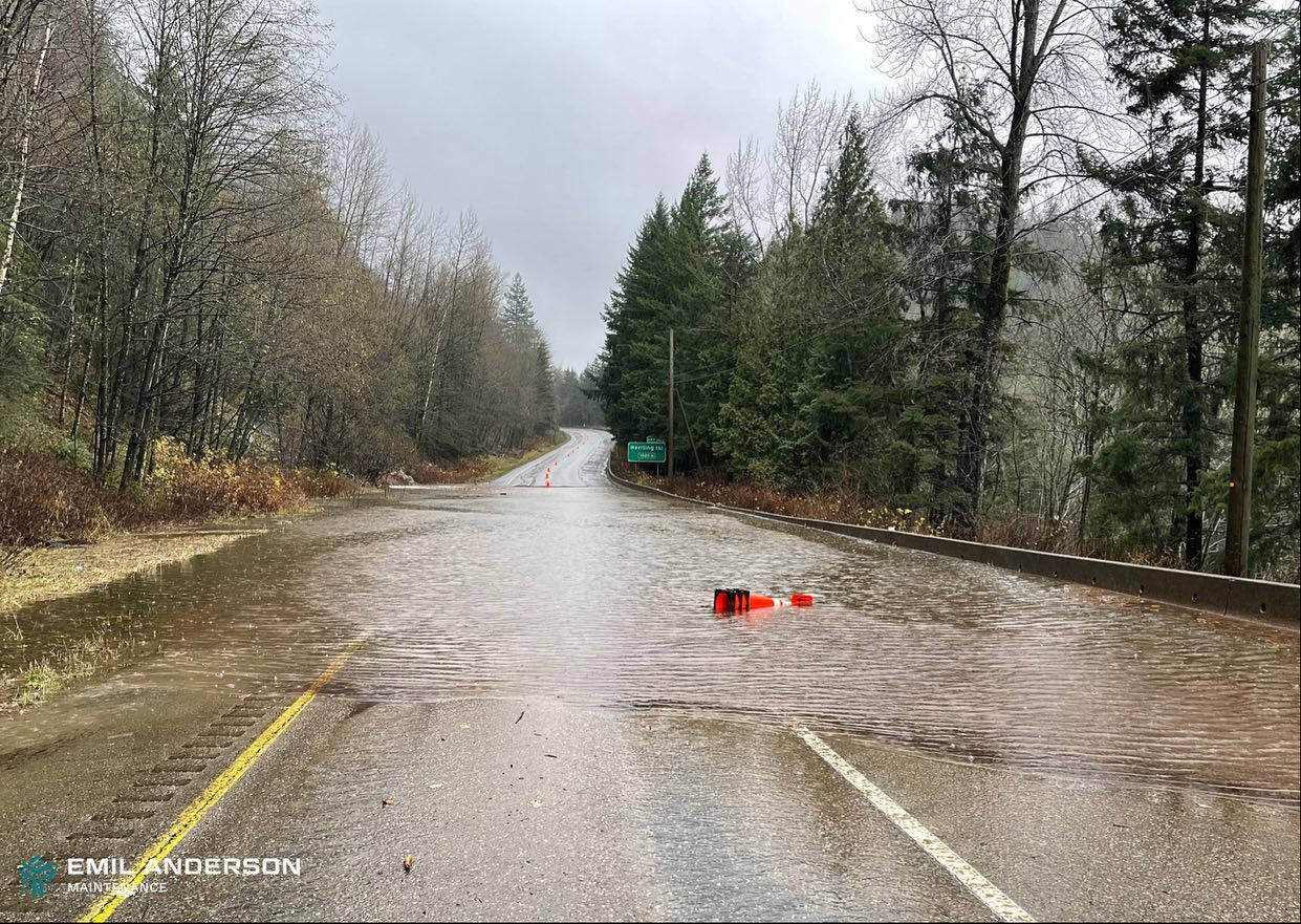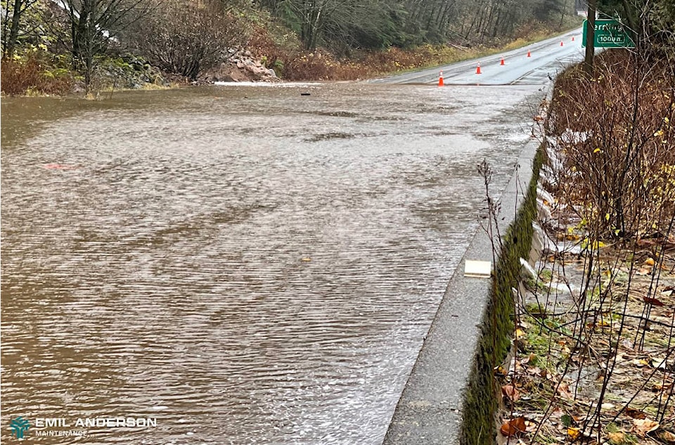
A highway maintenance company has shared their images of water streaming across Highway 1 near Hope.
Emil Anderson posted two photos of the westbound lanes at Herrling Island, which is between Popkum and Hope. Swift runoff water is flowing across the highway in the images. The photos were taken during the third atmospheric river event to hit the region in two weeks.
That section of Highway 1 has been closed for almost a week. It had been opened briefly after several landslides came down around Nov. 14, but mostly in the westbound lanes as a two-lane highway and a reduced speed of 50 km/hr.
“Water levels are high across westbound lanes,” Emil Anderson posted. “Stay safe out there.”
They have regularly been sharing images of the work being done along with updates on road openings and closures.
READ MORE: Tiger Dam on Highway 1 in Abbotsford is coming down
@CHWKcommunity
jessica.peters@hopestandard.com
Like us on Facebook and follow us on Twitter.
Want to support local journalism during the pandemic? Make a donation here.