Mission’s waterfront master plan has been completed, with city council unanimously approving the first reading on May 2.
A public hearing has been scheduled for June 20, one of the last steps before its adoption into the Official Community Plan (OCP), which guides all municipal development.
‘This council clearly had a vision, and it’s nice to see that we’re moving forward and in a sort of a measured approach to see it come to fruition,” said Coun. Carol Hamilton.
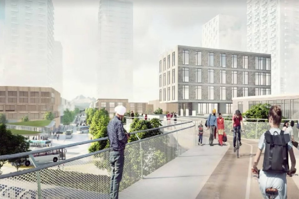
Gerald Schlesiger, project manager of the Waterfront Revitalization Master Plan (WRMP), called it “a bridge to Mission’s future.”
The WRMP sets out the guidelines for land-use planning for a 3.5-kilometre, 296-acre area for the lands south of Highway 11, from Lane Creek in the West, to the East End watercourse below Stave Lake Street.
Three different areas are proposed in the plan, each with its own unique features:
Mission Raceway and the Lane Creek estuary (128 acres) will not have its land use designations changed apart from five acres between the raceway and Highway 11 that will be used as employment lands. Civic infrastructure will be installed to the raceway’s property line for future opportunities.
There will be a land assembly on either side of the Mission Bridge (86 acres) under one ownership group. These lands have already been raised for flood protection levels and have been designated for employment uses.
The remaining lands east of the CPR Bridge involve 90 individual property owners with parcels ranging from 33 square metres to over 7 acres – land assemblies are likely necessary. The plan wants to focus on commercial and residential land uses here, with some hubs for public activities near the West Coast Express station.
Construction of the entire area is not anticipated to be complete for over 40 years.
The first decade of development will require heavy investments into infrastructure, including for flood protection measures, stormwater, sanitary sewers, watermains, and improving lift and pump stations. Associated engineering costs for the city are estimated at $212 million over 30 years.
Further municipal land acquisitions are also expected, but there are cost-recovery mechanisms available to the city, according to the plan.
All the areas will have a continuous river foreshore through development of a superdike, according to the WRMP, and the plan supports the extension of Highway 11 to connect with Highway 7.
WRMP is frequently described by staff and council as a “living document,” meaning it can add elements without further amendments to the OCP bylaw.
Its stated mandate: attract nationally scaled employers by leveraging the city’s “competitive advantage in rail, port and highway services”; create a hub of activity that will promote social interaction; integrate flood protection with amenities, and develop in a way that allows interaction with the edge of the Fraser River; increase accessibility to Mission’s historic downtown through pedestrian friendly links; and provide opportunities for culture and arts.
Mayor Paul Horn described the WRMP as a “highly agile approach.”
“It ends up being a balanced plan that offers a little bit of everything for people: residential, commercial, industrial – which for this guy, is really important – and community spaces, including institutional spaces,” Horn said.
RELATED: City of Mission releases interactive map detailing vision for future of waterfront