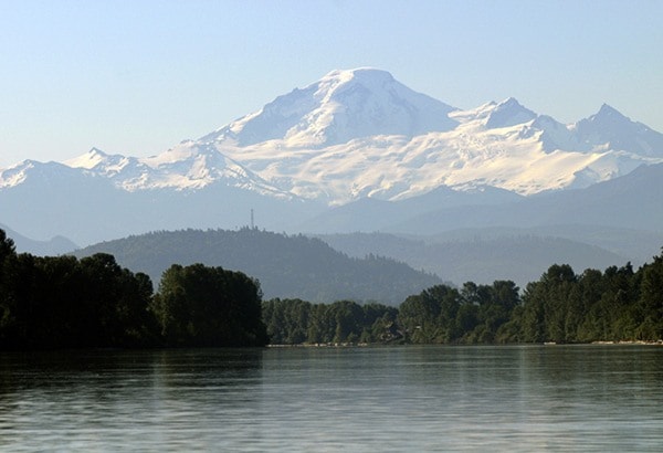
A Mount Baker eruption could send huge mudflows racing down hillsides and through valleys into the Sumas Prairie, where they could bury homes, farms, infrastructure and render the area unusable for years, according to a study on possible disasters the city could encounter.
The good news is that while the consequences could be dire, such a disaster is unlikely to happen this century. But the study, commissioned by the city as it looks to improve its emergency planning, suggests there are more-likely emergencies that could also do widespread damage to Abbotsford.
The city’s new Community Risk Assessment found earthquakes, floods and bad weather pose a “high risk” to Abbotsford and that more can be done to prepare for such events. Wildfires, human pandemics, urban fires, transportation disasters, dangerous goods spills and utility failures were all rated as “moderate risk,” while volcanoes, riots, landslides, and structural collapses were rated as unlikely to occur.
Fire Chief Don Beer, who is in charge of the city’s emergency planning, says nothing in the study was particularly surprising, but that it will be a valuable “road map” as council considers how to better prepare the city for a disaster.
After considering the assessment and its findings, council will be tasked with setting priorities to address.
The report focused on 14 different hazards that could require the city to establish an Emergency Operations Centre (EOC). Earlier this month, an EOC was activated to deal with the damage from a major windstorm, but it was just the second time in the last four years the city has operated an EOC. The last time was in 2012, when the Fraser River flooded parts of the Glen Valley.
A total of 55 potential city actions were identified, and while some are simple, like setting up a plan to warn homeowners to monitor snow levels on flat roofs, others would involve considerable resources. In setting priorities, the city will have to consider both the likelihood of a disaster, and the potential consequences. Fortunately, because many of the hazards pose similar challenges, including to infrastructure, victim assistance programs and municipal services, some suggestions – like exploring alternate drinking water sources – would help prepare the city for multiple types of emergencies. The city already conducts such “all-hazards” training sessions.
The probability and consequences associated with a major flood or earthquake put those two hazards front and centre. And while both dangers have been well-studied, the report suggests more can be done.
One of the challenges in responding to an earthquake, the report notes, would be the fact that outside assistance may concentrate on other affected Lower Mainland communities, delaying aid to Abbotsford.
Residents of Matsqui and Sumas prairies, along with the Glen Valley, are most susceptible to either disaster. The soil of the low-lying areas would amplify an earthquake’s shaking, increasing the potential damage to structures.
Similarly, all three areas are also at risk of flooding.

While the risk of a Fraser River flood to Abbotsford is similarly well-documented, the report also shines a light on the danger posed by the Nooksack River in northern Washington. The river has overflowed its banks before, and when it does, the water often flows across the border towards the Sumas Prairie. In 1990, one such flood swamped the Whatcom Road interchange, and just a few years ago, officials were getting ready to issue evacuation alerts to Huntingdon residents before a change in the weather.
Beer knows first-hand the hazards posed by the Nooksack, which can quickly rise due to a late fall snowfall and melt, or warm temperatures in January or February.
“I watch the Nooksack way closer than I watch the Fraser,” he said. While there is usually plenty of notice prior to the Fraser reaching high levels, the Nooksack, he said, is in a “real tight watershed,” and can also be adversely affected by high tides. Notice comes, in part, from a device installed along the river that can give the city advance warning that waters are peaking.
Some of the actions suggested throughout the report are already underway or part of ongoing efforts. The city is seeking funding to address erosion arcs that threaten the banks of the Fraser River in Matsqui. And the Abbotsford school district has four schools participating in a UBC study to test a system which detects unfelt waves that are released by a quake and which precede damaging tremors.
Recent events – notably the 2013 Lac Megantic rail disaster and the 2011 Christchurch earthquake – have increased awareness about the need to plan for disasters. Since Lac Megantic, rail companies must now turn over quarterly data about the amount of hazardous materials moving through cities. The city’s report noted that the bulk of such dangerous goods moving through Abbotsford involves flammable liquids and gases or corrosive material.
As for that Mount Baker eruption, the report notes that “Although Mount Baker is currently active, as evidenced by hot springs, the probability of a volcanic eruption is less than once in 1,000 years.” Still, with the potentially dire consequences of an eruption, the report suggested the city could develop a plan to respond to a possible event and address the vulnerabilities in its storm sewer infrastructure.
The city will host events associated with the annual Emergency Preparedness Week in early May. Among the activities, residents will be able to try out an earthquake simulator on May 2 at Highstreet shopping centre.