A Fraser River flood that would cause billions of dollars of damage is increasing in likelihood, according to a new study by the Fraser Basin Council.
That the Fraser poses a major flood risk is not new, but reports released Monday suggests climate change will make a major flood more likely, and that the region’s dikes are unlikely to stand up to the rising waters.
The reports – part of the “Lower Mainland Flood Management Strategy” undertaken by the Fraser Basin Council with the support of local municipalities, along with provincial and federal governments – says higher temperatures and more severe spring rainfall events could increase the likelihood of a devastating flood like that which inundated the region in 1894. While that flood had previously been considered a one-in-500-year event, those floods will grow in frequency as the climate changes, said Steve Litke, the Fraser Basin Council’s senior program manager for watersheds and water resources.
“A flood of that magnitude might shift from, say, a one-in-500-year flood to perhaps a one-in-100-year flood,” Litke said.
The report suggests that the valley’s flood defences are insufficient.
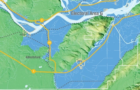
Dikes in Abbotsford, while not the worst in the system, are among dozens in the region that don’t meet provincial standards for crest height and seismic stability. Of the dikes protecting Abbotsford, several, including the Matsqui dike to the east of the Mission bridge, the Sumas Lake Reclamation dike in Sumas Prairie, and the northwest dike on the Vedder Canal are classified as “fair - poor.” The crest elevation of the Sumas dike is deemed “unacceptable,” as are large stretches of dike protecting Dewdney and Nicomen Island, north of the river, along with a short stretch of dike protecting Mission. The Matsqui dike to the west of the Mission bridge and the southwest segment of the Vedder Canal dike are two of only a few in the Lower Mainland classified as “poor - good.”

(ABOVE: View south from Mission showing the Fraser River in flood and inundation of Mission flats. The 1894 flood is the flood of record. Photo #P5673 courtesy The Reach)
Abbotsford Mayor Henry Braun says he wasn’t surprised by the study, and that the need to upgrade flood defences has been known for decades. While more meetings and studies are planned, Braun said he hopes the report generates a sufficient push to encourage senior levels of government to step up and invest in dike improvements.
“I think the general sentiment in local government is we’ve had lots of meetings,” he said. “We know what needs to be done. We need to do something now.”
But for that to happen, Braun said the federal and provincial governments must contribute money, with local governments having neither the jurisdiction or tax base to fund the improvements.
“If we get an above-average snowfall and heavy precipitation and a quick melt, I am concerned.”
The report says a major flood could see waters reach as far inland as the Sumas Way exit to Highway 1 and the McCallum Road intersection with Highway 11.
South of the Fraser in Abbotsford and to the east, a flood could do more than $2.8 billion in damage. The area would be among the most affected, with only Delta and Richmond suffering more.
In Abbotsford, Chilliwack, Hope and other eastern Fraser Valley areas south of the river, the report suggests a flood like that the one in 1894 would destroy 531 buildings, generate 371,955 tons of debris, and displace nearly 50,000 people. More than 1,300 buildings would be damaged. Hydro substations, transmission lines, rail lines, the James Treatment Plant, and two fire halls would be affected. Such a flood would also do considerable damage to communities further downstream, affecting the response in the Fraser Valley.
While Abbotsford Regional Hospital and Abbotsford International Airport wouldn’t be flooded, many of the access roads that would transport people to those two key facilities would be under water.
Abbotsford has the most farmland susceptible to a flood, with more than 10,000 hectares at risk and estimated agricultural losses more than $186 million.
Earlier this year, the province announced it would contribute $65 million to a disaster prevention fund, and in April the province said $4 million of that would go toward a project to prevent the further erosion of the river’s banks at Matsqui. On Monday, the province said it will provide $1 million to help implement the second phase of the flood management strategy, which will identify which dikes most urgently need fixing.