B.C. is facing smoky skies the likes of which it hasn’t seen in a couple years.
The smoke, which is coming from wildfires burning in the Western United States, has prompted air-quality advisories in many areas.
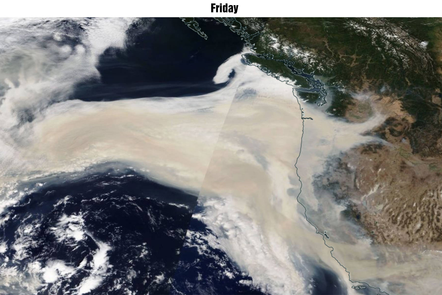
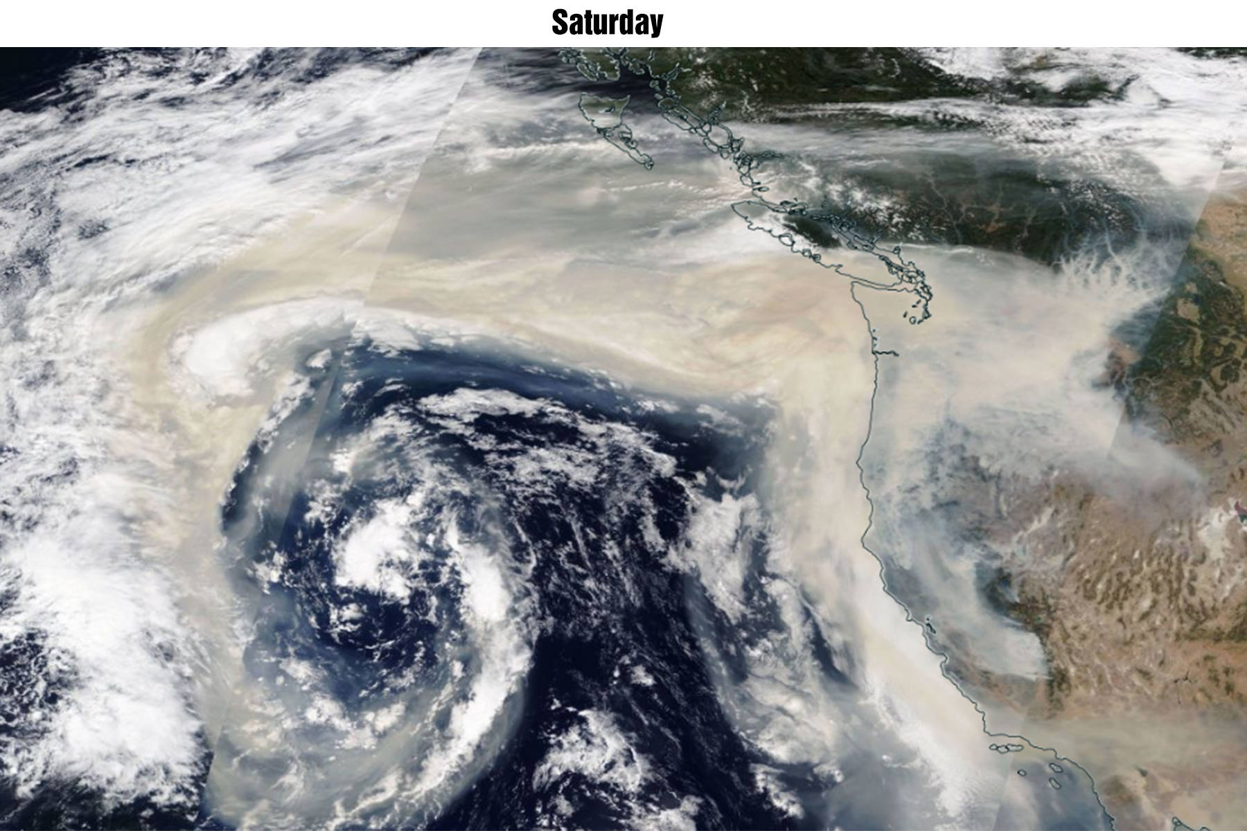
Satellite imagery from NASA shows how the smoke is flowing up the Pacific coast and impacting B.C.’s valleys.
The smoke has slowly spread across southwestern B.C., the images show. Click here for NASA’s interactive map.
RELATED: Smoke in Abbotsford hits new peak Sunday afternoon; particulate matter at 7 times healthy limit
RELATED: Smoke from distant fires in U.S. pose ‘very high risk’ for air quality in B.C.
VIDEO: Smoky skies from U.S. wildfires continue to cast a pall over Lower Mainland and Fraser Valley
Here are nearly 4 days worth of satellite images showing the journey of the smoke. Initially, it was pulled over the ocean by offshore flow. It was then caught up by westerly winds and pushed back onshore. An incoming system is now gradually pushing it to our east. #wawx pic.twitter.com/10F84yE1xp
— NWS Seattle (@NWSSeattle) September 13, 2020